


Yemen ranks among the ten most food-insecure countries globally and has child malnutrition rates of nearly sixty percent, the highest in the Arab World. These two figures underscore the country’s future social and economic development challenges.
Yemen Spatial, an online food security mapping and charting tool, was launched was launched last week in Sana’a at the joint Ministry of Planning and International Cooperation (MoPIC) and Food and Agriculture Organization Food Security Information System (FSIS) Inception Workshop.
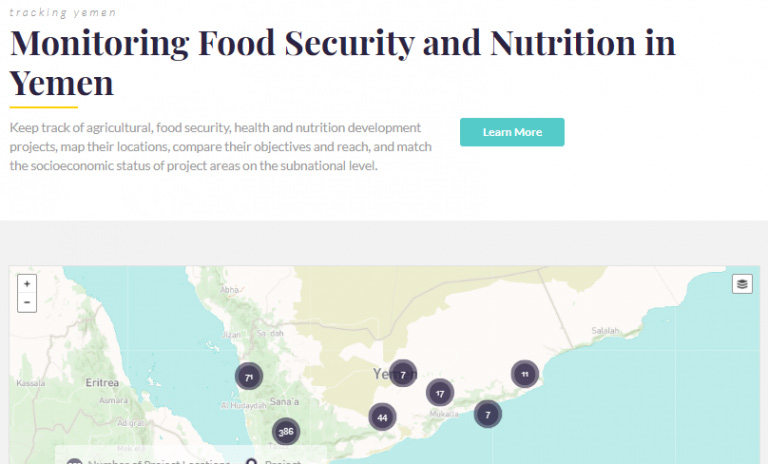
Yemen Spatial is a collaborative effort between Yemen’s Ministry of Planning and International Cooperation; MoPIC; IFPRI; the CGIAR Research Program on Policies, Institutions, and Markets (PIM); the International Fund for Agricultural Development (IFAD); and the German international development organization GIZ. The objectives of the tool are to support the implementation of Yemen’s National Food Security Strategy (NFSS), to monitor and evaluate progress in key food security indicators such as calorie deficiency and child stunting, and to strengthen food security by making data and information available for policy.
The tool aggregates a full range of development data and is designed to facilitate the monitoring of food security outcomes at the national, governorate, and district levels for precise targeting of interventions. As part of the region-wide Arab Spatial application, Yemen Spatial builds on this technology to provide more specific national and subnational level data, and emphasizes indicators that are tailored to Yemen’s food security challenges and capacity.
“By providing more than 100 data indicators—including climate, biophysical, and socioeconomic data—Yemen Spatial enables users to visualize areas that are most vulnerable to food insecurity and target policies and research where they are most needed,” said Perrihan Al-Riffai of IFPRI.
The tool adheres to an open access policy: end users can browse and query, free of charge, a full range of databases, build interactive multilayer maps, and use customized analytical tools that allow them to compare, explore, download, and share these results.
The selection of data for Yemen Spatial follows an innovative food and nutrition security framework embedded in Yemen’s NFSS, which highlights the complex relationship between factors that affect food security from the individual and household levels to the national level.
“The creation of the Yemen Spatial application is a step in the right direction for providing us with the capacity to monitor our progress toward a food-secure country” said Dr. Abdul Wahed Mukred, Head of Yemen’s Food Security Technical Secretariat.